Moorsbus, Connecting you across the North York Moors National Park
Selection of Maps

Moorsbus Network
Welcome to the Moorsbus Network map for 2026. It shows the operating routes from April through the end of September, indicating which services will run on Saturday, Sunday, Bank Holidays, or all those days. The 2026 route and timetable details are on the timetable page.
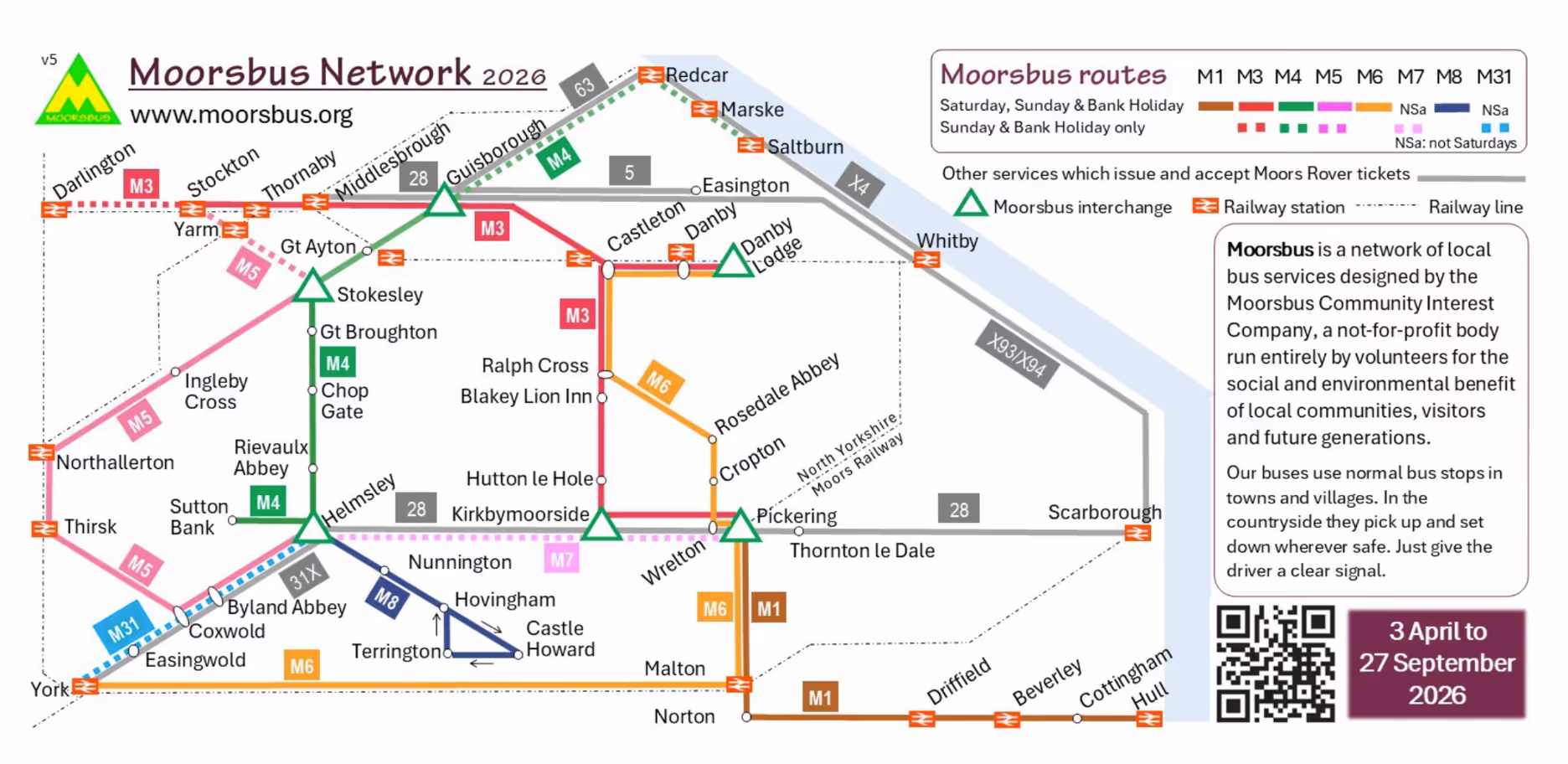
2026 network map, please click to download.
North York Moors National Park
North York Moors Area - Google Maps
Please Donate to Moorsbus
Donate to Moorsbus. Every contribution helps us greatly to provide the bus service.
